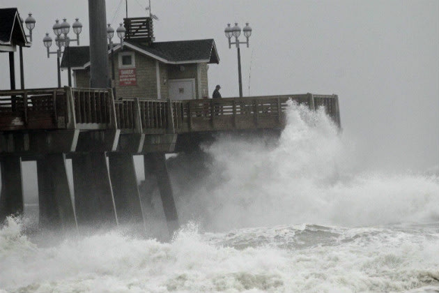
"Superstorm." "The Perfect Storm." "Frankenstorm." Whatever you want to call it, the East Coast is bracing for Hurricane Sandy, a "rare hybrid storm" that is expected to bring a life-threatening storm surge to the mid-Atlantic coast, Long Island Sound and New York harbor, forecasters say, with winds expected to be at or near hurricane force when it makes landfall sometime on Monday.
New York Mayor Michael Bloomberg ordered the immediate, mandatory evacuation for low-lying coastal areas, including Coney Island, the Rockaways, Brighton Beach, Red Hook and some parts of lower Manhattan along the East River. "If you don't evacuate, you're not just putting your own life at risk," Mayor Bloomberg said at a news conference Sunday. "You're endangering first responders who may have to rescue you."
Sandy is expected to continue on a parallel path along the mid-Atlantic coast later Sunday before making a sharp turn toward the northwest and southern New Jersey coastline on Monday--with the Jersey Shore and New York City in its projected path. But the path is not necessarily the problem.
"Don't get fixated on a particular track," the Associated Press said. "Wherever it hits, the rare behemoth storm inexorably gathering in the eastern U.S. will afflict a third of the country with sheets of rain, high winds and heavy snow."
A tropical storm warning has been issued between Cape Fear to Duck, N.C., while hurricane watches and high-wind warnings are in effect from the Virginia to Massachusetts. The hurricane-force winds extend 175 miles from the epicenter of the storm, while tropical storm-force winds extend 500 miles--or roughly 1,000 miles end to end, making Sandy one of the biggest storms to ever hit the East Coast.
"We're looking at impact of greater than 50 to 60 million people," Louis Uccellini, head of environmental prediction for the National Oceanic and Atmospheric Administration, told the Associated Press. "The size of this alone, affecting a heavily populated area, is going to be history making," Jeff Masters wrote on the Weather Underground blog.
According to the National Hurricane Center summary, coastal water levels could rise anywhere between 1 and 12 feet from North Carolina to Cape Cod, depending on the timing of the "peak surge." A surge of 6 to 11 feet is forecast for Long Island Sound and Raritan Bay, including New York Harbor. The storm surge in New York Harbor during Hurricane Irene in September 2011, forecasters noted, was four feet.


