An International Missionary Outreach Dedicated to Evangelizing the Lost  By Sharing The Gospel According to the Scriptures

To add your name to our Ministry Update List and/or our Prayer Partners List please enter your email address below and then click on the "Go" button.  People on our Ministry Update List will receive our weekly newsletter and periodic ministry updates. People on our Prayer Partners List will receive prayer requests from time to time.
Email:

Slideshow image


Since your web browser does not support JavaScript, here is a non-JavaScript version of the image slideshow:

slideshow image


slideshow image


slideshow image


slideshow image


slideshow image


slideshow image


slideshow image


In The News


In The News


Article: Misc. 
 

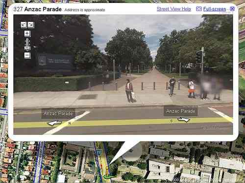
At first glance it looks like any other 3D map. But zoom in a little closer and you will see cars moving and people walking around - all in real-time. This is the world of ‘geo-immersion’ which blends the real and virtual worlds together to give the user the most interactive maps in the world.

The prototypes include a traffic tool which uses a standard Google map but overlays where cars are likely to be, using recent and historical data. This allows users to plot the fastest route to their destination.

Another application is called iCampus which gives real-time locations for friends who have tweeted or logged in to places on Facebook or Foursquare. Campus trams which are fitted with transmitters also appear on the maps so students can ensure they do not have to wait for them to turn up.

Also in development is iWatch which integrates
a 3D map of a city with real-time inserts by CCTV cameras which are overlaid on the top and spring to life when a user zooms in on them.

‘The idea was to capture a real world environment and then render it virtually so it feels like you are in that area.

The traffic map has been dubbed iTransportation and has so far only been developed for the Los Angeles area. ‘These historical patterns are created based on real-time data that we collect,’ said Mr Shahabi,

‘It shows how the trend of traffic changes over the course of time,’ he said, adding that his programme is able to offer a ‘fastest path’ option, which Google Maps cannot.


Read Full Article ....
Watch You Tube Video Clip ....


Understand The Times is an independent non-profit organization in Canada and the United States.
Understand The Times is not affiliated or dependent upon any other organization or denomination.
Understand The Times is accountable to a board of directors in the United States and Canada and accountable,
first of all, to Jesus Christ and His word.


Fair Use Notice


Home
Speaking Schedule | Ministry Update | Missions Updates
Goals and Objectives | Statement of Faith | History of Ministry | UTT Internet Bible School
Books  | DVDs | Tract Booklets | Commentary by Roger Oakland | Commentary By Others
Subscribe To Podcast | Podcast Information | Radio Programs and Transcripts | Articles | Weekly News In Review
2009 Year In Review | 2008 Year In Review | 2007 Year in Review Let There Be Light | Creation Gallery
Exposing The Emerging Church | Live Broadcasts | Broadcast Archives
  Join E-Mail Update List | Support The Ministry | Bryce Homes International  | Making Disciples Ministry

Mission Myanmar | Mission Kenya | Mission Philippines | Mission South Africa | UTT YouTube Channel
Lighthouse Trail Research

Understand The Times
International
P.O. Box 27239
Santa Ana, CA 92799 USA
(800) 689-1888

P.O. Box 1160
Eston, Saskatchewan
Canada S0L 1A0
306-962-3672